
End-To-End Detailed Road Design Capabilities In One Application
OpenRoads Designer is a comprehensive software for road project management, from planning to completion. It encompasses a wide range of capabilities, including:
- Plan and construction documentation
- Surveying and mapping
- Stormwater drainage design and analysis
- 3D visualization and simulation
- Geotechnical studies
- Underground utility design
WHAT IS OPENROADS DESIGNER?
OpenRoads Designer is a comprehensive and fully functioned detailed design application for surveying, drainage, subsurface utilities, and roadway design that supersedes all capabilities previously delivered through InRoads, GEOPAK, MX, and PowerCivil.- You Don’t Work in a Silo and Neither Should Your Software
From integrating existing conditions to working with other project partners, OpenRoads’ model-centric approach makes it easy to work with different data types, disciplines, and distributed teams. - It Is All About the Details
Reduce highway design time with a complete toolset for survey, drainage, utilities, and roadway detailed design in one application. Start with real data, and create accurate, georeferenced 3D designs with real-world context through the seamless integration of reality data and design information. - 2D, 3D, and Beyond
Whether you need to produce traditional 2D deliverables, advance to 3D modeling, support digital transformation, or all the above, OpenRoads is the choice for road design.
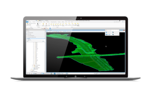
MODEL AND ANALYZE TERRAINS
Create intelligent models containing not only terrain data, but also roadway or site features. You can use features to visually distinguish structure, appearance, and symbology in the design.
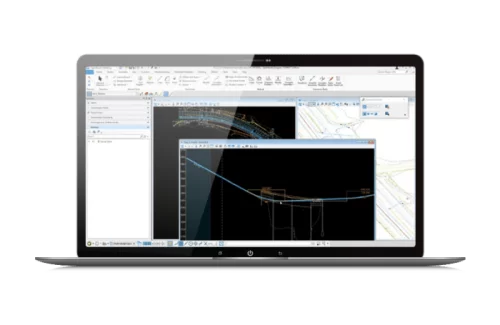
CREATE HORIZONTAL AND VERTICAL ALIGNMENTS
Use object-oriented coordinate geometry and alignment design capabilities that provide intelligent updating as you quickly create precision horizontal and vertical alignments. Use elevation profiles to display surface information, as well as vertical alignments associated with horizontal alignments.
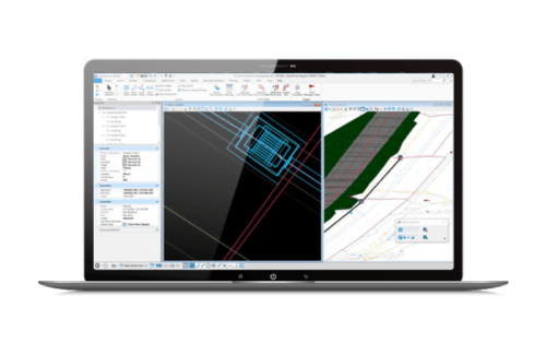
DESIGN AND MODEL STORMWATER DRAINAGE
From the creation of models from 2D artifacts and external data, through steady and unsteady state hydraulics and hydrology, to BIM and plans production, you’ll reduce design time with a complete toolset in one application.
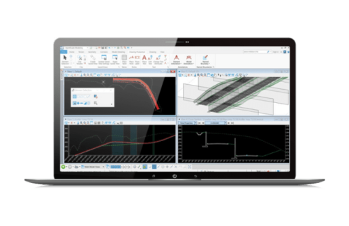
CREATE PROFILES AND CROSS-SECTIONS
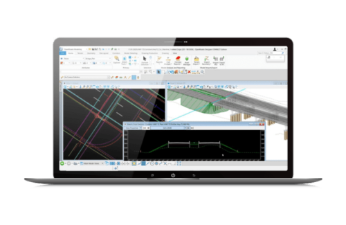
Create profiles and cross-sections from any point within the design. View updates on the fly as the design is modified with dynamic cross sections. You can see the ground changing to reflect design edits. Include surface features, corridor components, and notations, such as construction limits or stationing.
DESIGN, MODEL AND ANALYZE CORRIDORS
Use immersive corridor modeling capabilities that support complex modeling and file federation demands required by BIM Level 2 and beyond. Streamline the complex development of every aspect of the roadway in a single, parametric presentation. You can move rapidly along a corridor at controlled intervals, viewing and dynamically designing all roadway components in concert.
Technical Capabilities
- All MicroStation functionality
- Production drafting
- Create parametric solids, surfaces, meshes, and feature models
- Item types for custom attribution
- Reporting and tables
- Easily integrate hundreds of geographic coordinate systems
- Printing and plotting
- Integrate CAD data in many formats: DGN, DWG,DXF, PDF/U3D, IFC, Rhino 3DM, STL, VRML World, and SketchUp SKP
- Integrated visualization capabilities
- LumenRT visualization
- ProjectWise integration
- Plan and profile sheet generation
- Cross section sheet generation
- Sheet and object annotation
- Reporting
- Synchronization with iModelHub
- Export to common formats: DWG, DXF, LandXML, and IFC
- Read and write standard raw survey formats
- Survey data reduction
- Feature coding for custom survey feature connectivity, display, and annotation
- Adjustments: least squares, compass, crandall, and transit
- Dynamic graphical and tablular editing of survey field book data
- Parking lots
- Pad layout
- Parcel layout
- Horizontal geometry (arc or chord)
- Horizontal geometry – clothoid spirals
- Vertical geometry (parabolic or circular)
- Horizontal and vertical best fit
- Customizable geometry reports
- Query gINT® project files
- Display borehole locations
- Display borehole cross sections
- Display borehole fence diagram
- Annotate boreholes
3D models of drainage and utilities are quickly becoming a necessity; however, road design, drainage design, and utilities modeling are often completed by separate team members utilizing different software. Working in a vacuum leads to lack of coordination across disciplines, costly mistakes from out-of-date data, and missed opportunities to address conflicts. OpenRoads can help you with everything from the creation of models from 2D artifacts and external data, through steady and unsteady state hydraulics and hydrology, to BIM and plans production.
- 3D modelling of utilities, storm, and sanitary drainage
- Steady-state (e.g. rational method) hydraulic design and analysis
- Culvert design and hydraulic analysis
- Unsteady-state hydraulic analysis
- Pond design and analysis
- Hydraulic analysis of low impact developments
- Site grading optimization
- Profile modeling
- Dynamic cross sections
- Earthworks – triangulated volumes
- Earthworks – end area volumes
- Customizable earthwork reports
- Superelevation
- Corridor modeling
- Raster images
- Attach point cloud
- Attach reality mesh
- Point cloud classification
- Reality mesh edit, drape, and extract tools
- Scalable terrain models
- Import from LandXML
- Label contours and spot points
- Display contours, triangles, spots, and flow arrows
- Import from 20+ common formats (graphics, point clouds, ascii, InRoads®, GEOPAK, MX, LiDAR, and DEM)
- Import from Esri, USGS, and SRTM services
- Create complex and delta terrain models
- Edit terrain models
- Transform terrain models
Our STAAD.Pro Customers


